Electrical Resistivity Tomography (ERT) is a geophysical technique used to image subsurface structures based on variations in the electrical resistivity of the ground. This method involves injecting electrical currents into the ground and measuring the resulting potential differences. ERT has various applications across different fields. Here are some of them:
-
Geotechnical Site Investigations:
- ERT uses in geotechnical engineering to assess the subsurface conditions before construction projects. It helps in identifying variations in soil and rock properties, detecting anomalies, and assessing the stability of the ground.
-
Environmental Site Assessments with Electrical Resistivity Tomography:
- ERT is employed in environmental studies to investigate and monitor the distribution of contaminants in the subsurface. It aids in identifying the extent of pollution, tracking the movement of contaminants, and assessing the effectiveness of remediation efforts.
-
Groundwater Exploration and Monitoring:
- ERT is valuable for mapping the distribution of groundwater and detecting subsurface water-bearing structures. It helps in identifying potential locations for wells, monitoring changes in groundwater levels, and assessing aquifer properties.
-
Mineral and Resource Exploration:
- In the mining industry, ERT is used for mapping subsurface geological structures and identifying potential mineral deposits. It aids in mineral exploration by providing information about the composition of the subsurface.
-
Archaeological Investigations:
- ERT is applied in archaeology to map and visualize buried structures, artifacts, and archaeological features without excavation. It helps archaeologists in planning and targeting their excavations more effectively.
-
Civil and Structural Engineering:
- ERT uses in civil and structural engineering to assess the condition of infrastructure elements such as foundations, tunnels, and dams. It helps in identifying voids, anomalies, and potential weaknesses in the subsurface.
-
Landslide and Slope Stability Studies with Electrical Resistivity Tomography:
- ERT employees to assess the stability of slopes and detect potential landslide-prone areas. It provides information about subsurface geological features that may contribute to slope instability.
-
Mapping Karst Features:
- ERT is useful in karst terrain, where the dissolution of soluble rocks (such as limestone) can create subsurface cavities. It helps in mapping the distribution of karst features and assessing potential sinkhole risks.
-
Infrastructure Planning and Design:
- ERT utilized in the planning and design of infrastructure projects, including roads, bridges, and tunnels. It provides information about subsurface conditions that may impact the construction and long-term stability of structures.
-
Pipeline and Cable Route Planning:
- ERT applies to plan the routes of pipelines and underground cables. It helps in identifying potential obstacles, assessing soil conditions, and optimizing the placement of infrastructure to minimize environmental impact.
ERT is a versatile geophysical tool that provides valuable insights into the subsurface, making it applicable in a wide range
Methodology of ERT survey?
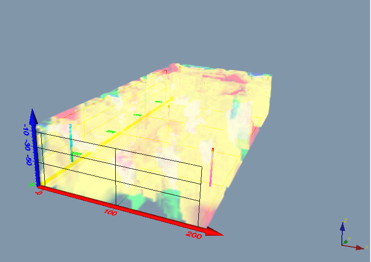
ERT is a geophysical technique for imaging sub-surface structures from electrical resistivity measurements made at the surface
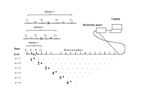
2-D electrical resistivity tomography (ERT) carries out with a multi-electrode resistivity meter system. Such surveys use many electrodes laid out in a straight line with constant spacing. A computer-controlled system is then used to automatically select the active electrodes for each measure. A computer-controlled system is then used to automatically select the active electrodes for each measure.
Equipment of the Electrical Resistivity Tomography?
We get the resistance (R) data from KYORITSU and the LUND Imaging System.
- KYORITSU soil resistivity meter: 01
- The Multi-core flexible cables: 02 rolls
- The Electrodes: 70
- The hammer used for piling: 02
- The laptop: 01
- RTK GNSS for position: 01
The implementation process of Electrical Resistivity Tomography?
Based on the principle of equipment operation, the survey includes 2 processes:
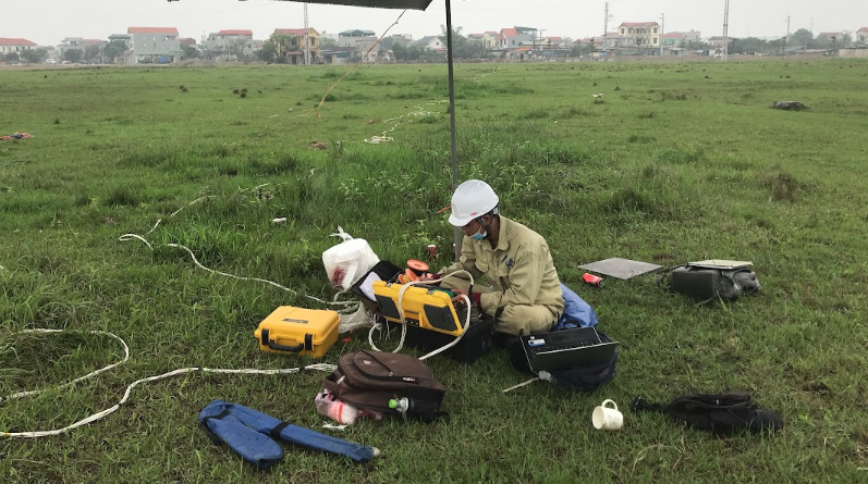
– Field survey to collect data.
Firstly: Check the machine and set the proper machine operating parameters
Secondly: Setting up the survey lines
Thirdly 3: Conducting the survey, collecting the GPS coordinates
Next: Entering the data sent to the processing office
– Analyzing and processing results with specialized software in the office.
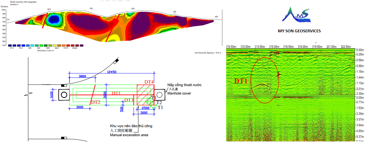
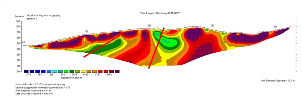
Recommendation of the reference 2-D profile ERT results?
From the ERT results, we need to drill an exploration well at the low resistivity zone: the exploration well 1 (G1) at the location 380m to evaluate the groundwater potential in fractured rock.
Proposed well: Drilling a well down to 100m depth, the diameter of the hole is 219mm, and the casing pipe design is 168mm, we just drive the casing pipe run to protect loose the upper soil, in the hard rock zone does not need the casing pipe to obtain optimal flow rate. It is necessary to select a suitable capacity pump to stabilize the water zone.
My Son Applied Science Research Company is a leader in electrical resistivity tomography ERT services in Vietnam And Southeast Asia.
Please contact our hotline at +84 963 247 151 or E-mail: mysoncrsa@gmail.com for foreign service
Hotline for the Quotation: +84 0902 307 382